Last updated 8/2022
MP4 | Video: h264, 1280×720 | Audio: AAC, 44.1 KHz
Language: English | Size: 11.97 GB | Duration: 4h 40m
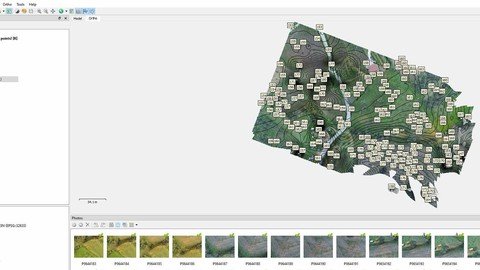
How process drone data and extract the major information like Ortophotos and DSM
What you’ll learn
Acquisition Data with Drone – Planning Mission use UgCs
Processing Data : Allign Photos – Insert Markers – Manage the point cloud
Filtering Cloud Point – Classification Supervised and Unsupervised
Create Ortophoto – Extract DTM and Contours
Comparision between Drone Tecnique and Remote Sensing
Requirements
Have a PC and basic knowledge of computer science – topography
Using Internet
Description
Course is focued on the complete system and technique to acquire, plan and process data drone instead to obtain typical product like DTM – DSM – Contour and Ortophotos. The course will be divided into ten theoretical and practical lessons, which involve the use of specific software, mostly opensource. There are also intermediate tests with quiz questions and the issue of a final certificate. The training project will be structured in such a way as to be usable both to university students and to professionals who want to undertake a more specific training path that facilitates them in the working world. The Structure for Motion technique will be analyzed in detail, as well as the alignment techniques of the photos taken both in the context of terrestrial and area photogrammetry. Point cloud analysis methodologies and systems, point cloud filtering techniques; up to the reconstruction of objects in three dimensions. The cost is extremely accessible. The classes will consist of a maximum of 12 students. We will be very happy to have positive feedback and to know that you will be autonomous in the processing of drone data. This is a basic level to which an advanced level will most likely follow, also for the analysis of thermal and infrared data, useful in precision agriculture, in avalanche prevention, in energy diagnosis of buildings, as well as in diagnostics of photovoltaic systems.
Overview
Section 1: COURSE
Lecture 1 introduction to photogrammetry and drone acquisition mapping
Lecture 2 introduction to the principles of cartography and photogrammetry
Lecture 3 drone mission planning using ugcs and dronedeploy
Lecture 4 download drone data and start processing dronedeploy
Lecture 5 point cloud segmentation – classification ( automatic and manual)
Lecture 6 from point cloud to mesh model
Lecture 7 from point cloud to DTM, DSM and contour Model – how manupulate Point Cloud.
Lecture 8 ortomosaic image from drone data elaboration and present cartografic results
Lecture 9 economic aspects of drone tecnique and comparison with remote sensing
Develop the skills and abilities to acquire a drone project and process it to obtain orthophotos and DTM,Extract information from drone data
Homepage
www.udemy.com/course/processing-drone-data-with-open-source-software/
Buy Premium From My Links To Get Resumable Support,Max Speed & Support Me
Fikper
xlltp.Drone.Data.Processing.part12.rar.html
xlltp.Drone.Data.Processing.part05.rar.html
xlltp.Drone.Data.Processing.part07.rar.html
xlltp.Drone.Data.Processing.part10.rar.html
xlltp.Drone.Data.Processing.part01.rar.html
xlltp.Drone.Data.Processing.part02.rar.html
xlltp.Drone.Data.Processing.part06.rar.html
xlltp.Drone.Data.Processing.part03.rar.html
xlltp.Drone.Data.Processing.part11.rar.html
xlltp.Drone.Data.Processing.part09.rar.html
xlltp.Drone.Data.Processing.part04.rar.html
xlltp.Drone.Data.Processing.part13.rar.html
xlltp.Drone.Data.Processing.part08.rar.html
Rapidgator
xlltp.Drone.Data.Processing.part01.rar.html
xlltp.Drone.Data.Processing.part04.rar.html
xlltp.Drone.Data.Processing.part08.rar.html
xlltp.Drone.Data.Processing.part11.rar.html
xlltp.Drone.Data.Processing.part02.rar.html
xlltp.Drone.Data.Processing.part05.rar.html
xlltp.Drone.Data.Processing.part12.rar.html
xlltp.Drone.Data.Processing.part03.rar.html
xlltp.Drone.Data.Processing.part09.rar.html
xlltp.Drone.Data.Processing.part06.rar.html
xlltp.Drone.Data.Processing.part10.rar.html
xlltp.Drone.Data.Processing.part07.rar.html
xlltp.Drone.Data.Processing.part13.rar.html
Uploadgig
xlltp.Drone.Data.Processing.part08.rar
xlltp.Drone.Data.Processing.part13.rar
xlltp.Drone.Data.Processing.part11.rar
xlltp.Drone.Data.Processing.part01.rar
xlltp.Drone.Data.Processing.part02.rar
xlltp.Drone.Data.Processing.part04.rar
xlltp.Drone.Data.Processing.part05.rar
xlltp.Drone.Data.Processing.part10.rar
xlltp.Drone.Data.Processing.part06.rar
xlltp.Drone.Data.Processing.part12.rar
xlltp.Drone.Data.Processing.part07.rar
xlltp.Drone.Data.Processing.part09.rar
xlltp.Drone.Data.Processing.part03.rar
NitroFlare
xlltp.Drone.Data.Processing.part06.rar
xlltp.Drone.Data.Processing.part03.rar
xlltp.Drone.Data.Processing.part09.rar
xlltp.Drone.Data.Processing.part11.rar
xlltp.Drone.Data.Processing.part12.rar
xlltp.Drone.Data.Processing.part10.rar
xlltp.Drone.Data.Processing.part01.rar
xlltp.Drone.Data.Processing.part08.rar
xlltp.Drone.Data.Processing.part02.rar
xlltp.Drone.Data.Processing.part13.rar
xlltp.Drone.Data.Processing.part05.rar
xlltp.Drone.Data.Processing.part07.rar
xlltp.Drone.Data.Processing.part04.rar
Links are Interchangeable – No Password – Single Extraction


Leave a Reply
You must be logged in to post a comment.